
Field Trips
Immediately after the conference, a field trip to some of Greece's features is planned, offering the attendees the chance to explore the wonders of Greece and discover new experiences and sensations. Participants will be able to explore and uncover many mysteries of local history. MedGU field trips are fun and educational, so accompanying persons are also welcome to join in. However, trips are not suitable for children younger than 10 years old. Please click below to learn more about the field trip:
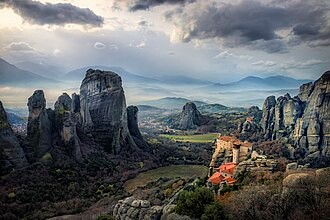
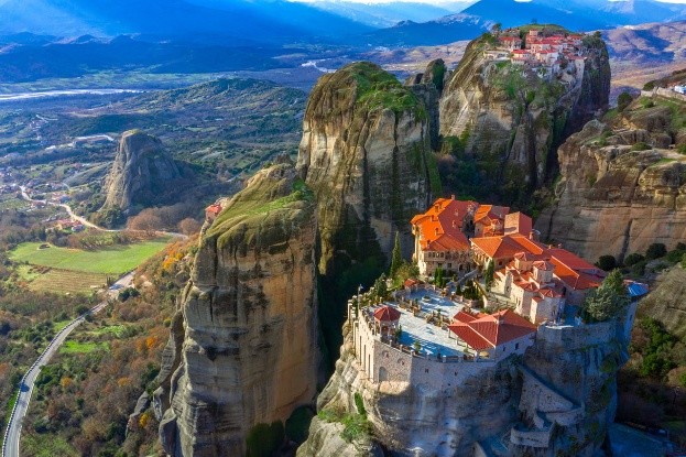
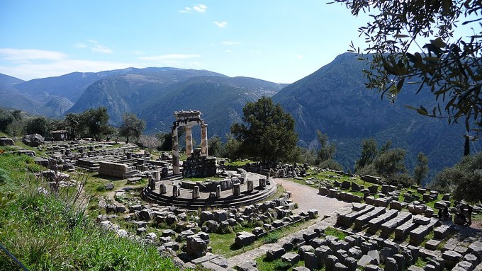
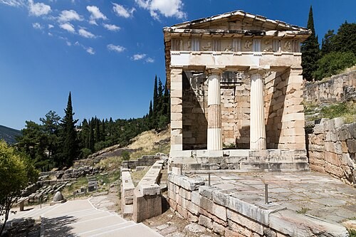
Field Trip 1: Meteora & Delphi UNESCO World Heritage Sites
Meteora, located in central Greece near the town of Kalambaka, is a geological and cultural marvel that uniquely blends natural wonder with human history. Geologically, the towering rock pillars were formed over 60 million years ago during the Paleogene period, when a river delta deposited layers of sandstone and conglomerate. Tectonic activity and continuous erosion by wind and water sculpted these vertical cliffs, some rising over 400 meters, into their present form. Archaeological findings in the surrounding caves, such as Theopetra Cave, indicate human presence dating back over 50,000 years, making the area one of the oldest continuously inhabited regions in Greece. During the Byzantine era, starting in the 14th century, Orthodox Christian monks established monasteries atop the nearly inaccessible peaks as a retreat from political turmoil and invasions. These monasteries, built with remarkable skill and persistence, became centers of spiritual life, art, and scholarship. Meteora today is a UNESCO World Heritage Site, celebrated for its rare combination of geological grandeur and deep archaeological and religious significance.
Delphi, nestled on the slopes of Mount Parnassus in central Greece, was one of the most important religious and cultural centers of the ancient Greek world. Known as the sanctuary of Apollo, it was believed to be the omphalos—the navel of the world—where heaven and earth met. The site is most famous for the Oracle of Delphi, where the Pythia, a priestess of Apollo, delivered cryptic prophecies that influenced major political and military decisions across the Greek world. Archaeologically, Delphi is rich with remains including the Temple of Apollo, the theater, the treasuries of various city-states, and the stadium used for the Pythian Games. These structures reflect the site's religious significance and its role as a hub of artistic and athletic excellence. Geologically, Delphi lies on a fault line, and some theories suggest that natural gases emitted from underground fissures may have contributed to the trance-like state of the oracle. Today, Delphi is a UNESCO World Heritage Site, offering a compelling glimpse into the spiritual, political, and intellectual life of ancient Greece.
Dates: 13-14 November 2025
Cost: €330 per person at a twin room, €400 per person at a single room
Minimum number of participants: 30
It includes
- 1-night stay at twin or single room with breakfast
- 2 meals (dinner at Meteora and lunch at Delphi)
- Transport costs
- Visit to the Delphi archaeological site
- Visit to the Meteora site
The package doesn’t include
- Accommodation taxes
- Private insurance
- Gratuities
